Fort Mosta - Mosta, Malta - Earth-Covered Military Structure Above the Countryside
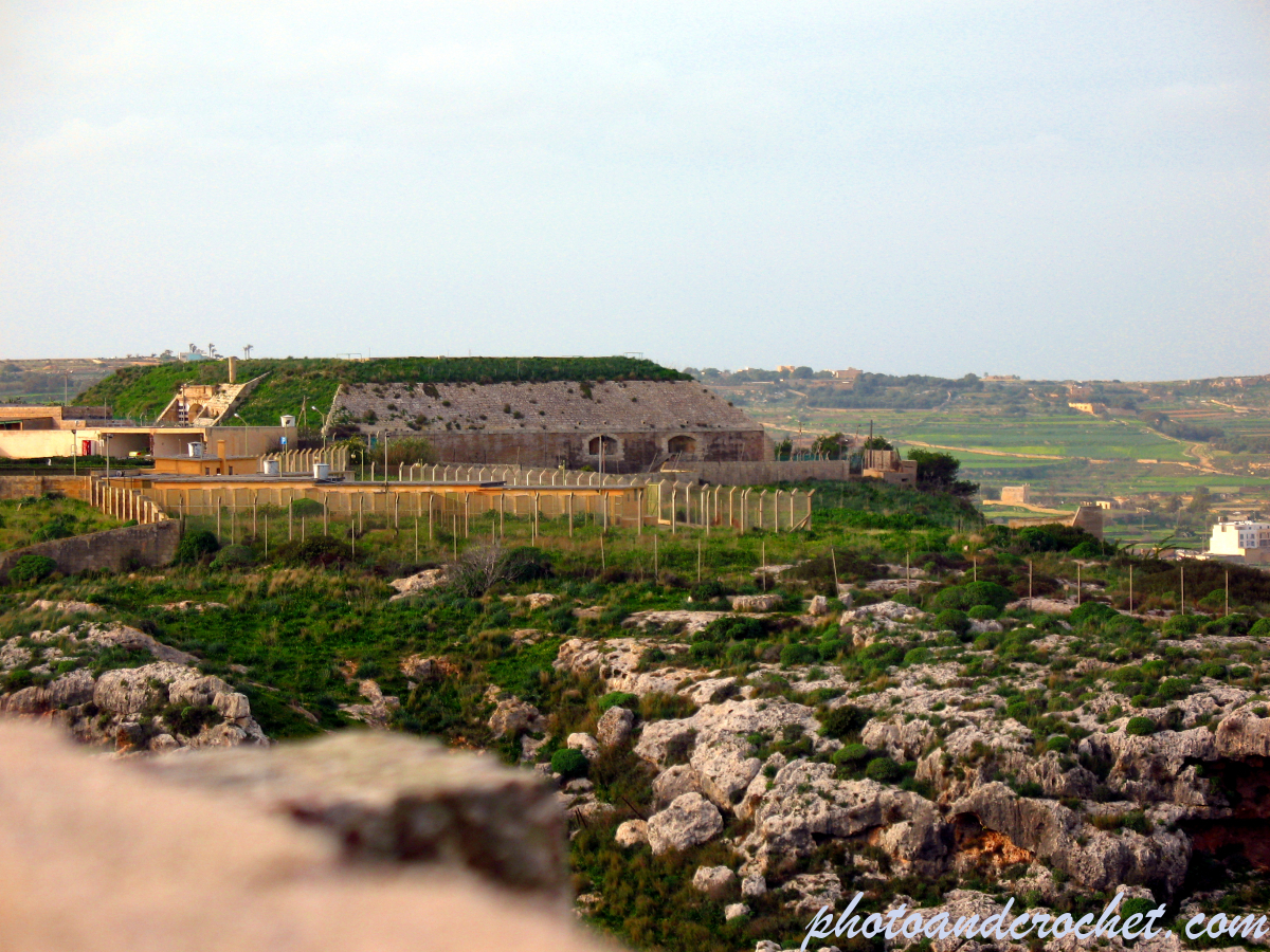
A view of Fort Mosta, Malta, showing an earth-covered military structure, surrounding security fencing and buildings overlooking the rocky countryside along the historic Victoria Lines.
This photograph shows part of Fort Mosta, a historic British military fortification situated along Malta’s Victoria Lines defensive system. The central feature is a low, earth-covered structure with a weathered stone façade and several visible openings, positioned on elevated ground above the surrounding countryside. A series of fences and posts extends across the foreground, enclosing the military compound and separating it from the rocky landscape. Additional buildings and structures are visible to the left, while green agricultural fields and distant settlements stretch across the background. The foreground is dominated by rugged limestone outcrops, scattered stones and Mediterranean vegetation, illustrating the natural terrain surrounding the fort.
Fort Mosta was constructed by the British during the late nineteenth century as one of the principal strongpoints of the Victoria Lines, a defensive system developed along Malta’s Great Fault escarpment. Together with Fort Binġemma and Fort Madalena, it formed part of a network intended to protect the strategically important southern regions of the island from a possible invasion approaching from the north. The elevated location allowed the fort to command important routes through the natural ridge, while its artillery positions and protected military structures supported the surrounding defensive installations. Earth-covered buildings and substantial limestone construction were important features of nineteenth-century military engineering, helping protect personnel, equipment and supplies. Following the decline of the Victoria Lines as an active defensive barrier, Fort Mosta continued to serve military purposes and became associated with ammunition storage. The structures visible in this photograph illustrate the fort’s continuing adaptation beyond its original defensive role. The image also highlights the relationship between the military compound and the surrounding Maltese landscape, where historic fortifications, rocky escarpments and agricultural countryside remain closely connected.
You have to be logged in to leave a comment
Comments
No comments yet.
Fort Mosta - Mosta, Malta - Earth-Covered Military Structure Above the Countryside
by Dieter
Uploaded on July 6, 2022
Prev | Next |
| Camera: | Canon |
| Model: | Canon PowerShot A630 |
| Creation Date: | 2016:05:27 21:22:46 |
| Image width: | 3264 px |
| Image height: | 2448 px |
| Image size: | 6.74MB |
| Aperature: | f/4.1 |
| Exposure: | 1/500 |
| ISO - speed: | Unavailable |
License for images free to download:
Creative Commons CC BY-NC-ND 4.0
Please give the image a rating.
The average rating is 2.98.